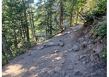
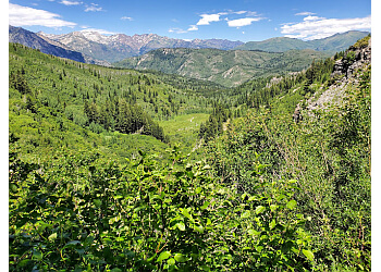
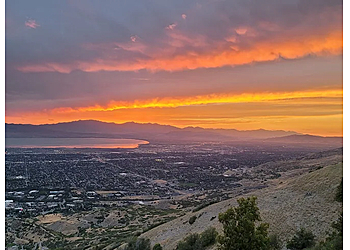
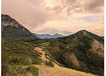
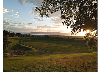
Rock Canyon Park, located in Provo, UT, is a well-maintained hiking trail and the biggest park in the city. The park is one of the most stunning and is situated above the Provo LDS temple and at the foot of the mountains. The trailhead has a 9.2 km out-and-back trail that takes an average of 3 hours 27 minutes to complete. There is a gate at the east end of the parking lot. Squaw Peak offers a lovely walk with breathtaking views of the valley and Utah Lake. There is a spacious open area that can accommodate multiple activities simultaneously, making it perfect for large gatherings and family reunions. The park has features like Sprawling green space with a trail & playgrounds, a volleyball court, horseshoes, and disc golf.
UNIQUE FACTS:
• Playgrounds Available
• Dog Friendly
• Scenic Views.
3 Best Hiking Trails in Provo, UT
Expert recommended Top 3 Hiking Trails in Provo, Utah. All of our hiking trails actually face a rigorous 50-Point Inspection, which includes customer reviews, history, complaints, ratings, satisfaction, trust, cost and general excellence.
ROCK CANYON REVIEWS
Great hiking. Bring an umbrella it is worth it. There is a nice little creek, depending on the time if year, that gives you an opportunity to cool off. We went mid June so the creek was still flowing. There is a Park as well as a Conyon. The a canyon is the hike the park is the grassy hidden park away from the traffic. It is kind of in a bowl with a little creek. The best place for ice blocking. We also saw other with a slip and slide type contraption that worked very well.
Awesome large park with hiking trails, pavilions, playgrounds, etc. There is a large 'bowl' which was used for the outside Hope of America program (2021 Covid restrictions). It was great for this and they even brought in a helicopter to celebrate the legacy of the 'candy bomber'.
A great place for hiking, having fun, relaxing, amazing views, new playgrounds for kids to enjoy, and have lots of picnic tables around the whole park! I would recommend this park!!
Help others: Click Here to send review or send us your review to reviews@threebestrated.com. Negative and positive review will be used for rating. Make a difference.
Scout Falls is a well-maintained hiking trail in Provo, UT. The trailhead is beautiful and leads to American Fork Canyon and Scout Falls. Scout Falls is also accessible from Provo Canyon. It starts at the foot of Mount Timpanogos, at the Timpooneke Trailhead. Although this trail has an elevation climb, it is relatively steep. A few damp areas of the trail are from little waterfalls up near the top. To traverse to drier land, you can pause on a rock. In the trail to reach a higher ledge, there is one area where you must climb up over some tree roots. The Timpooneke Trailhead in American Fork Canyon, also reachable from Provo Canyon via the Alpine Loop, serves as the trail's starting point.
UNIQUE FACTS:
• Offers Free Parking
• Restroom Facilities
• Opens Year-round.
Specialty:
$Price:
Contact:
Working Hours:
TBR® Inspection Report:
SCOUT FALLS TRAIL REVIEWS
One of my favorite short hikes in the area. Springtime the falls are gushing all over the rocks and absolutely amazing. The fall the colors contrast with the rock cliffs. It's beautiful no matter when you go here. Special day today as we scattered our little bud named Charlie. He was a good dog and let his spirit entertain you as you wander through this beautiful place! Shall you all have a little bit more happiness as you head home.
Great, moderate hike. Beautiful views, and a great drive to get to the trailhead and back. We went late afternoon on a Friday /holiday and ran into quite a few hikers but still had time to ourselves.
Great hike and in the afternoon mostly in the shade, 6 year old handled it with no problem. 3 miles round trip from parking lot to falls. Some small water runoff patches on the trail.
Help others: Click Here to send review or send us your review to reviews@threebestrated.com. Negative and positive review will be used for rating. Make a difference.
Y Trailhead is a mountain located directly east of Brigham Young University (BYU) in Provo, Utah, United States. The Slide Canyon, also known as Y Mountain Trail, features an elevation gain of 1,074 feet (327 m) over a 1.06-mile (1.71-kilometer) distance, culminating in a large block Y. The BYU symbol was constructed as this hillside letter more than a century ago. The hike to the Y has long been one of Utah Valley's most popular hiking routes because it offers a beautiful perspective of Provo, Orem, the remainder of the valley's numerous communities, and Utah Lake. The trail is also frequently used by hikers, bicyclists, paragliders, and hunters to access the wilderness in the Slide Canyon region.
UNIQUE FACTS:
• Picnic Tables Available
• Dogs Allowed
• Breathtaking Views.
Specialty:
Contact:
Working Hours:
TBR® Inspection Report:
Y TRAILHEAD REVIEWS
Y Trailhead was such a great Hike to do! It’s definitely a must if you’re a outdoor lover. It has a total of 13 turns to make it to the very top of the Y. There’s Lots of signs with information about the Y’s history, distance, altitude and some of the wild life, plants and trees in the area. I very much enjoyed this hike. Will definitely be doing it again.
It's a great hike if you are looking for something short but difficult. Plan on 35 - 50 minutes up and the same going down. There are 13 switchbacks to the top of the Y. It IS uphill all the way. I am using it to get back in shape after my knee replacements. Surprisingly, there are people who can run it both directions!
Awesome trailhead that can take you north or south on the Bonneville Shoreline Trail, or straight up to the Y. Past the Y you enter Slide Canyon and can access a networks of other hikes. Great views of Utah Lake.
Help others: Click Here to send review or send us your review to reviews@threebestrated.com. Negative and positive review will be used for rating. Make a difference.