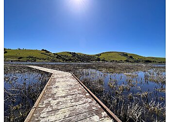
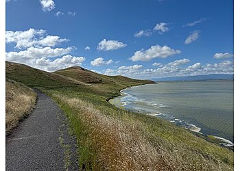
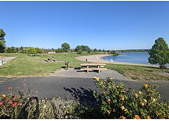
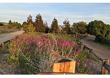
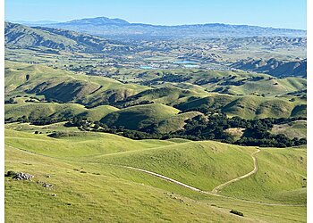
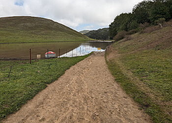
3 Best Hiking Trails in Fremont, CA

Expert-recommended Top 3 Hiking Trails in Fremont, California. All of our hiking trails actually face a rigorous 50-Point Inspection, which includes customer reviews, history, complaints, ratings, satisfaction, trust, cost and general excellence. You deserve only the best!

CALL EMAIL

MISSION PEAK REGIONAL PRESERVE

4.9 (117)
43600 Mission Boulevard,
Fremont, CA 94539 Directions

Since 1990

Specialty:

Walking Horseback Riding Hiking Wildlife Radio Control (R/C) Flying Forest Lake Mountain Biking Birding Backpack Camp Naturalist-Led Activities Dogs on Leash Running Road Biking Wild Flowers

Mission Peak Regional Preserve is a perfect destination for biking, hiking, horseback riding, R/C flying, and hang-gliding. The park welcomes hundreds of tourists trying the 3-plus-mile hike to Mission Peak, particularly on weekends. The 550-mile multi-use loop is designed along the San Francisco Bay hill and mountain ridgelines. The elevation gain of the trail is 2152 feet, and it is a loop type trail. It takes approximately 3 hours and 59 minutes to complete the total trail. Visitors can also enjoy 29-mile hiking and biking in the most scenic landscape of southern Alameda County. Mission Peak Regional Preserve also features picnic tables, public restrooms, and wheelchair accessible parking lot for more comfort.

Reviews | Play Video | Write a Review

Contact:

(510) 544-3247 (888) 327-2757

Mon-Sun: 6:30am - 9pm

TBR® Inspection Report:

CALL EMAIL

COYOTE HILLS REGIONAL PARK

4.8 (116)
8000 Patterson Ranch Road,
Fremont, CA 94555 Directions

Since 1967

Specialty:

Nature Trips Fishing Hiking Bird Watching Bicycling Running Birding Road Biking Beach Lake Wild Flowers Picnicking Exploration Mountain Walking Jogging Wildlife

Coyote Hills Regional Park is a regional park that covers 1,266 acres of marshland and grassland-lined hills. The park offers various recreational opportunities, such as bicycling, walking, and bird-watching. This park's rich history includes mission-related activities, settler ranching, and agriculture. The park has an extensive network of hiking paths, most of which are accessible to equestrians, and 3.5 miles are accessible to cyclists. This regional park is the site of the Tuibun Ohlone Village, which is more than 2,000 years old. Hiking through the regional park ensures scenic views of the surrounding San Francisco Bay and Southern Alameda County areas. Coyote Hills Regional Park also features two picnic areas and one reserved campground for the convenience of visitors.

Reviews | Play Video | Write a Review

Price:

Per Vehicle$5

Contact:

TBR® Inspection Report:

CALL

QUARRY LAKES REGIONAL RECREATION AREA

4.7 (113)
2100 Isherwood Way,
Fremont, CA 94536 Directions

Since 1997

Specialty:

Wildlife Viewing Geo-Seeking Trails Bicycling Volleyball Picnicking Hiking Canoeing and Kayaking Swimming Boating Fishing Camping Scavenger Hunt Nature Trips Birding

Quarry Lakes Regional Recreation Area provides attractive opportunities for travelers to walk and ride bicycles. The park's trail path links to the regional path of Alameda Creek, which runs from Niles Canyon west to the Coyote Hills and the Don Edwards Wildlife Sanctuary on the Bay of San Francisco. The elevation gain of the trail is 22 to 82 feet, which is generally considered an easy trail route. This stunning water-oriented leisure area offers more activities that include picnicking and boating. Visitors can swim at the authorized beach, picnic, play volleyball and fish, and enjoy watercraft powered by non-gasoline. Quarry Lakes Regional Recreation Area also has plenty of drinking water fountains, public restrooms, and picnic tables for more comfort.

Reviews | Play Video | Write a Review

Price:

Parking
Per vehicle$5
Per trailered vehicle$4
Buses$25

Contact:

TBR® Inspection Report: