3 Best Hiking Trails in St Paul, MN

Expert-recommended Top 3 Hiking Trails in St Paul, Minnesota. All of our hiking trails actually face a rigorous 50-Point Inspection, which includes customer reviews, history, complaints, ratings, satisfaction, trust, cost and general excellence. You deserve only the best!

10+ YEARS IN TBR
CALL EMAIL

FORT SNELLING STATE PARK

101 Snelling Lake Road,
St Paul, MN 55111 Directions

Since 1962

Specialty:

Visitor Center Walking Culture Scenic Drives Hiking Wildlife Natural History Swimming Geocaching Biking Picnicking Cross-Country Skiing Boating Canoeing Winter Recreation Fishing and Hunting Museum Birds NPS Passport Program

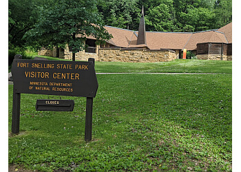
Fort Snelling State Park covers nearly 3,000 acres, which ensures a magnificent outdoor experience. The trail provides 12 miles of groomed and tracked ski trails, 6 miles of multi-use trails, and skijoring and dog sledding are allowed on 7 miles of trail. The elevation gain of the trail is 699 feet. This trail is generally considered an easy trail route. Fort Snelling State Park also offers extensive biking and skiing trails that connect with Minnehaha Park and the National Wildlife Refuge in the Minnesota Valley. Visitors also enjoy various activities like a golf course with nine holes, picnic areas, and bird watching. Dogs are allowed in designated leash areas.

Reviews | Play Video | Write a Review

Price:

Entry Fee $7

Contact:

  • fortsnelling.statepark@state.mn.us
(612) 279-3550 (612) 279-3559

Mon-Sun: 8am - 10pm

TBR® Inspection Report:

Hidden Falls Regional Park - St Paul, MN Hiking Trails
6+ YEARS IN TBR
CALL EMAIL

HIDDEN FALLS REGIONAL PARK

1313 Hidden Falls Drive,
St Paul, MN 55116 Directions

Since 1887

Specialty:

Hiking Boat Launch Benches Biking BBQ Grill Pits Fire Pit Birding Picnic Area Restroom Facilities and Shelter Picnicking Walking Fishing

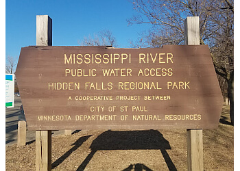
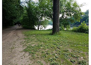
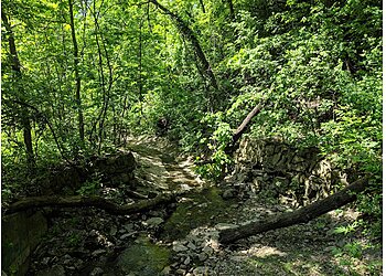
Hidden Falls Regional Park has approximately 6.7 miles of paved trails that offer a beautiful environment for a stroll, run, or ride in the afternoon. The trail provides a free outdoor exercise program all summer long. The elevation gain for the trail is 59 feet, and it is loop-type. The time taken to complete the total trail is approximately 26 minutes. The open shelter covers 12 out of 16 picnic tables and seats about 60 people. Visitors can quickly walk through the woods to find a hidden waterfall fed by the rain. Hidden Falls Regional Park also features plenty of grassy space, picnic areas, public restrooms, barbecue grills, kid-friendly hikes, picnic tables, and a wheelchair-accessible parking lot for the convenience of the visitors.

Reviews   |   Write a Review

Contact:

(651) 632-5111 (651) 266-6400

Mon-Sun: 6am - 10pm

TBR® Inspection Report:

10+ YEARS IN TBR
CALL EMAIL

BATTLE CREEK REGIONAL PARK

2300 Upper Afton Road,
St Paul, MN 55119 Directions

Since 1996

Specialty:

Hiking Winter Recreation Cross Country Skiing Birding Walks Biking Public Transit Bus Access Family-Friendly Pet-Friendly Wildlife Playground Creative Play Picnicking

Battle Creek Regional Park is a 1,840-acre natural park that features 3.3 miles of multi-use trails and 3.3 miles of single-track mountain biking. This trail is located 5.2 miles from St Paul. The trails have an elevation gain of 377 feet, and it is a loop trail. The time taken to complete the total trail is 1 hour and 13 minutes. The trail allows tourists to see various wildlife species like deer, egrets, and hawks, as well as the park's natural plant habitats. Battle Creek Regional Park features one large pavilion that can accommodate up to 500 people and various picnic shelters. The trail also has handicap-accessible restrooms, a large playground, and a nature play area. Dogs are also welcome in leash areas.

Reviews | Play Video | Write a Review

Contact:

(651) 748-2500 (651) 266-0300

Mon-Sun: 5am - 11pm

TBR® Inspection Report: