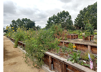
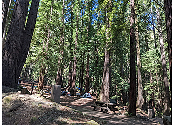
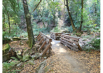
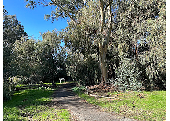
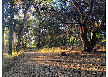
3 Best Hiking Trails in Santa Clara, CA

Expert-recommended Top 3 Hiking Trails in Santa Clara. All selected hiking trails undergo our rigorous 50-Point Inspection, assessing reviews, reputation, history, price, proximity, and more to ensure excellence. No Pay-to-Play!

CALL EMAIL

ULISTAC NATURAL AREA

4901 Lick Mill Boulevard,
Santa Clara, CA 95054 Directions

Since 2001

Hiking Jogging Camping Walking Park Outdoor Activities Forest Biking Flowers Wildlife Area Nature Preserve & Bird Watching

Ulistac Natural Area was the sole designed natural open area that ensures an unforgettable experience for visitors. The Ulistac Natural Area is a cultural and regional resource for all of us. The different habitats of native California plants and the ecosystems they sustain are enjoyed by visitors from all over the area who come to walk, exercise, take pictures, ride bikes, observe birds, and simply find a peaceful escape from their busy lives. The final 40 acres of natural, unspoiled land in the city are located at Ulistac along the Guadalupe River, a significant bird migration route. Invasive species are removed by volunteers, who then plant native trees, shrubs, grasses, and wildflowers in California.

Reviews | Play Video | Write a Review

Contact:

(408) 615-3140

Mon-Sun: 7am - 8pm

TBR® Inspection Report:

CALL

SAN TOMAS AQUINO CREEK TRAIL

Monroe Street,
Santa Clara, CA 95051 Directions
Hiking Jogging Running Wildlife Area Trips Road Biking Trail Running & Walking Views

San Tomas Aquino Creek Trail ensures various activities like road biking, running, walking, and enjoying some solitude during quieter times of the day. The total length of the trail is 20.3 kilometers for hiking; generally, the trail is considered easy. The elevation gain of the trail is 66 meters. The trail type is out and back type. The time taken to complete the total trail is 3 hours and 47 minutes. The trail is open 365 days a year and is beautiful to visit anytime. The trailhead is wheelchair and kids-friendly. There are at least 4 designated accessible spaces in the paved parking lots off Caribbean Drive at the trail's north end. They are van-accessible with striped access aisles. The trail surface is asphalt, brick, cement, dirt, gravel, or wooden bridge (with railings), and typically ranges from 4 to 8 feet wide.

Reviews | Play Video | Write a Review

Contact:

TBR® Inspection Report:

CALL

SANBORN COUNTY PARK

16055 Sanborn Road, Saratoga,
Santa Clara, CA 95070 Directions
Hiking RV Camping Historic Site Horseshoe Pit Wedding Picnicking Interpretive Program Nature Trails Volleyball Walking Dogs on Leash Mountain Biking Campsites Group Site & Paved Trails

Sanborn County Park is a 3453-acre densely forested area that offers hiking and other low-intensity outdoor activities. The Santa Clara County Parks and Recreation Department is in charge of the park. Sanborn County Park is home to Silicon Valley's only outdoor Shakespearean company during the summer. Hikers' OverviewSanborn County Park, located on the steep canyon eastern slopes of the Santa Cruz Mountains, offers one of the coolest summer trails for Hikers. Sanborn County Park is 9.0 miles from downtown Santa Clara. The Park also features various picnic tables and also dog-friendly.

Reviews | Play Video | Write a Review

Contact:

TBR® Inspection Report: