3 Best Hiking Trails in San Francisco, CA

Expert-recommended Top 3 Hiking Trails in San Francisco, California. All of our hiking trails actually face a rigorous 50-Point Inspection, which includes customer reviews, history, complaints, ratings, satisfaction, trust, cost and general excellence. You deserve only the best!

CALL EMAIL

MUIR WOODS NATIONAL MONUMENT

Mill Valley,
San Francisco, CA 94941 Directions

Since 1908

Specialty:

Hiking Biking Cycling lanes Kid-friendly activities Kid-friendly hikes Picnic tables Walking Jogging

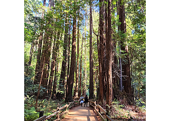
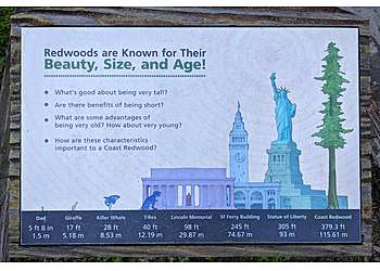
2026 Update: Muir Woods National Monument forested park features large redwood trees, extended hiking trails, and a visitor center. Located a few miles from Mill Valley, it can be accessed on foot via the Dipsea Trail. Bicyclists typically reach the area using Muir Woods Road from Panoramic Highway or Frank Valley Road from Highway Access to the main entrance is limited, and reservations are required. Visitors using public transportation should plan for a round-trip hike of about three miles with moderate elevation change. The visitor center offers limited WiFi and a pay phone for communication. In the surrounding area, Deer Park Fire Road is a designated route suitable for biking and connects to Mount Tamalpais State Park. Muir Woods National Monument is located within the Golden Gate National Recreation Area in northern California, just north of San Francisco. The site is known for its tall old-growth redwood trees and a network of trails that pass through areas such as Cathedral Grove and Bohemian Grove, as well as along Redwood Creek. Hiking routes like the Ben Johnson and Dipsea trails lead up the hillside and provide views of the treetops, the Pacific Ocean, and Mount Tamalpais in the nearby state park.

Reviews | Play Video | Write a Review

Price:

Standard Entrance Pass $15
Annual Entrance Park Pass $45
America The Beautiful Pass (Includes Senior Passes) $250
Resident Annual Pass $80
Senior Annual Pass $20
Senior Lifetime Pass $80

Contact:

(415) 561-2850

Mon-Sun: 8am -8pm

TBR® Inspection Report:

10+ YEARS IN TBR
CALL EMAIL

TWIN PEAKS

501 Twin Peaks Boulevard,
San Francisco, CA 94114 Directions

Specialty:

Hiking and Trails Hill Station City Lights Picnic Area Stunning Views Walking Trails Biking Running Sunny Day Rock Formations Visitor Centers Picnics Kid-friendly hikes Dog-friendly Golf Courses Swimming Pools

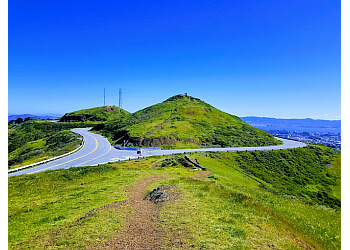
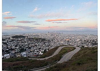
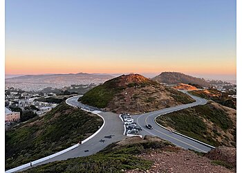
"Twin Peaks is 922 feet in elevation and features a grassy 64-acre hilltop with hiking trails leading to wind-swept peaks. This offers a 360-degree view of the Bay Area. The total length of the trail is 2.1 miles, which is generally considered an easy route. It takes approximately 52 minutes to complete the total trail. This is an out-and-back route. The original name of the location was "Los Pechos de la Chola." The two neighboring peaks offer postcard views and a variety of animal and plant life. Visitors can also hike the 0.7-mile trail network that ascends the two peaks. They can also enjoy sunrise, sunset, and night views.

2026 Update: Twin Peaks hiking trails lead to elevated, wind-exposed peaks that offer wide views of the Bay Area. The landscape mainly consists of grassland and coastal scrub, with strong winds common along the routes. Hikers pass through areas with native plants such as coyote brush, lizard tail, pearly everlasting, and lupine. The habitat also supports local wildlife, including the endangered Mission Blue butterfly, as well as birds like the white-crowned sparrow and animals such as brush rabbits and coyotes."

Reviews | Play Video | Write a Review

Contact:

(415) 831-2700 (415) 831-6331

Mon-Sun: 5am - 12am

TBR® Inspection Report:

8+ YEARS IN TBR
CALL

LANDS END

680 Point Lobos Avenue,
San Francisco, CA 94121 Directions

Since 2012

Specialty:

Hiking Trail Running Mile Rock Beach The Labyrinth and Lands End Point Shipwrecks Visitor Centers Bikes and Dogs

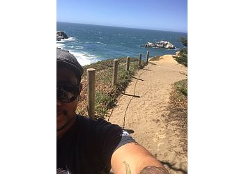
Lands End Coastal Trail is a walking path in San Francisco that begins near the Cliff House and follows the edge of coastal bluffs through wooded areas before ending in the Sea Cliff neighborhood near China Beach. The trail includes a short paved section at the start, while most of it is made up of dirt paths, rocks, and some steep stairways. It is generally an easy-to-moderate hike, about 1.5 miles long, with scenic views of the bay, the Golden Gate Bridge, and the coastal cliffs. Certain sections allow biking, including parts between Merrie Way parking lot and Mile Rock Beach, as well as an upper trail starting from Fort Miley that runs parallel to the main route and connects to the Palace of the Legion of Honor. The trail offers waterfront hiking with views of wildflowers along the route and access to the Sutro Baths ruins, along with coastal scenery that includes views of a nearby shipwreck site.The Lands End Lookout parking area offers electric vehicle charging services with a fee of $0.40 per kilowatt hour. After a full charge is completed, an additional idling fee of $2 per hour applies.

Reviews | Play Video | Write a Review

Price:

Entrance Fee Per Person $15

Contact:

TBR® Inspection Report: